
 News
Industry News
Insights | Applications of Visual AI in Highway Operational Safety
News
Industry News
Insights | Applications of Visual AI in Highway Operational Safety
 May 10.2024
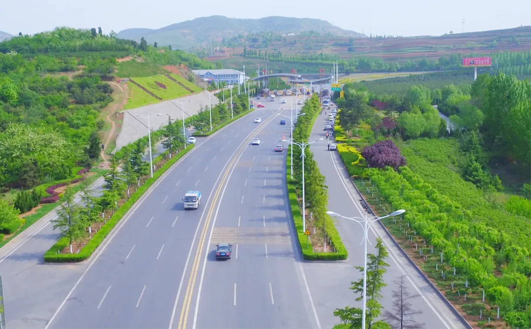
In recent years, China's highway network has expanded rapidly, yet the maintenance and management of critical infrastructure—such as roads, bridges, tunnels, and slopes—face significant challenges. With relatively low automation in monitoring systems, the ability to detect hazards like road subsidence, cracks, collapses, structural deformations in bridges/tunnels, and geological risks such as landslides or rockfalls remains limited. These constraints pose risks to highway operational safety.
What is Visual AI?
Visual AI, the integration of machine vision and artificial intelligence, enables machines to "see" and interpret visual data. Its core principle lies in using algorithms and models to analyze images and videos, extract actionable insights, and execute decisions or tasks based on these analyses.
Key Applications of Visual AI in Highways
Road Surface Monitoring
Deploying high-definition cameras on roadside towers, Visual AI enables real-time detection of road subsidence, cracks, and collapses. Advanced image processing and machine learning algorithms automatically identify crack locations, lengths, and widths, facilitating early intervention for pavement defects.
Bridge and Tunnel Structural Monitoring
Visual AI supports high-frequency monitoring at 120Hz, meeting the demands for measuring static and dynamic deflections in bridges. Static deflection reflects long-term structural deformation trends, while dynamic deflection indirectly indicates structural damage severity. For tunnels, multi-point displacement analysis across cross-sections enables precise monitoring of convergence and uneven settlement.
Geohazard Prevention
Visual AI employs specialized image-processing algorithms to capture millimeter-level deformations, delivering real-time horizontal and vertical displacement data for quantitative risk assessment. Additionally, grid-based camera arrays mounted on towers or poles scan slopes and unstable rock masses, generating 100-million-pixel panoramas through image stitching. This system tracks rockfall trajectories, crack propagation, and other anomalies, enabling holistic hazard monitoring and localized risk identification.
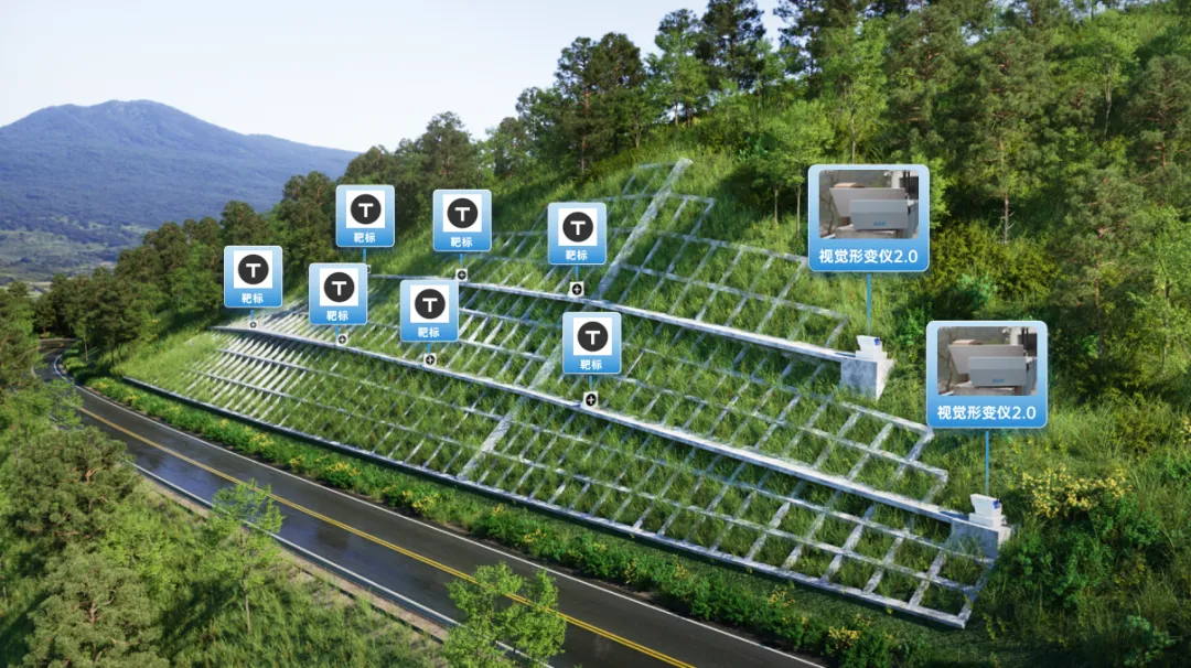
▲ Visual AI for Highway Slope Monitoring
To further enhance infrastructure safety, complementary technologies like MEMS accelerometers and DAS (Distributed Acoustic Sensing) fiber optics can be integrated, creating a 24/7, multi-dimensional monitoring system combining point, linear, and area coverage.

▲ Series of Intelligent Sensing Devices
Innovative Solutions: "Safety-Zone" Monitoring
In geologically complex, high-risk, or bridge/tunnel-intensive highway sections, a "Safety-Zone" monitoring framework can be implemented:

7×24 - hour service hotline
Company Address
Floor 8-11, Building 5, No. 8-5, Keji Avenue, Yuhang Street, Yuhang District, Hangzhou City, Zhejiang Province

Follow Us
RUHRloT

Follow the public number
RUHRloT


